Saturday, 30 October 2010

Walking the hills of São Miguel island


Me walking the top of steep hills close to Lagos de Fogo. São Miguel Island. Portugal.


Location: Thursday morning walk. I met a lot of wind and constantly changing weather conditions which are so typical for this of of the highest areas of the São Miguel island. That morning I started from the road EN24 and begin a slow descent to the Rocha dos Campos village ( here is a google map ). We are heading tonight for a couple of days to Tenerife island so I hope to bring some nice pictures back here.
Gear: Nikon D80
Exposure bias: - 1/3 EV
ISO: 100
Date Taken: October 21th, 2010, 10:55

Maciek.

Wednesday, 27 October 2010

Islands in the Autumn

 
Mosteiros beach in rain. São Miguel Island.

Location: The summer was over and dark clouds from the western Atlantic appeared on the Azores skies. I stood that night taking photos in the rain, beaten by wind and waves. My camera and filters were soaking. But it was all worth it. Awarded the front page of http://onephoto.net/?p0=2&p1=6 Photographed at the beach of Mosteiros, Westernmost part of the São Miguel island, Azores, Portugal.


Gear: Nikon D80, ND hard 0.6

Aperture: f/11 Exposure bias: +1/3 EV

Shutter speed: 2 sec

Focal Length: 11 mm

ISO: 100

Date Taken: October 20th, 2010, 19:55
PS. Also awarded the front page of http://www.obiektywni.pl/

Maciek.

Monday, 25 October 2010

Day 9 and 10: The Napa Valley

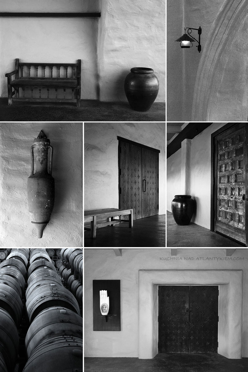
We spent two days riding up and down the Napa and Russian Valleys. We´ve tasted old Zinfandel wines, been to small family run wineries in Dry Creek Valley and visited big Disneyland-like wine producers in Oakville. Just two days of fun, talks in tasting rooms, meeting nice people, eating in Don Giovani restaurant. Swirl, sniff and spit...
Photos from the Robert Mondavi winery.
Maciek.

Sunday, 24 October 2010

Day 11: Sacramento and Columbia State Historic Park

After leaving city of Napa we drove to Sacramento, a capital of the California State. Sacramento old town turned out to be very pleasant. We parked the car, walked the streets along the riverfront with19th century style beautifully renovated shops, cobblestone roads, antique houses. It was all simple and rustic beauty that used to epitomize the Old West the way I like it very much. Afterwards we went to the small Rush Era museum where we meet a very nice lady who was working there. She told us a story of Sacramento as the epicenter of the 19th century California gold rush with such an enthusiasm that we fall in love with Sacramento at ones. There are many wonderful things about the United Stated we have been slowly discovering during out trips to this country over the last 6 years. World-famous natural landmarks, big cities, nice restaurants with free refills, general feeling of safety while you travel and many more, but none is more outstanding than the friendliness of the people. All the people you meet are friendly, kind and with an immediate will to bing you help.
Sacramento old district.
From the Sacramento we took highway 41 scenic road south. The landscape was nice with groves of trees, old farm houses and pastures. This was the land when California Gold Rush took place. In 1984 the gold was discovered in the creeks here up the mountains and people went crazy. Almost overnight 40.000 people poured into this area. In a decade 400.000 people looked for gold in this hills. Some of the towns are being preserved as they were at the time. One of the most intriguing places to explore is old Columbia, now turned into a State Historic Park.
Gold Rush Era general store at Columbia.
Maciek.

Wednesday, 20 October 2010

Day 12: Yosemite National Park, the Tunnel View


Tunnel View.
This is one of the most photographed views of the Yosemite Park. We are standing on the west edge of the valley looking east. From the left: El Capitan with its massive 1400 m wall of rock ( the world´s largest exposed rock ), Half Dome in the middle standing 1600 meters above valley floor, Cathedral Spirals peaks with its Bridaveil Fall merely visible in the summer.

Maciek.

Tuesday, 19 October 2010

Day 13: The Yosemite National Park

Valley View near Pohono bridge, Merced river, late afternoon. From the left: El Capitan, Cathedral Spires with a Bridalveil falls.
We have already been to Yosemite in 2005 but that year only managed to see its Northern part: the Tuolumne Meadows. This time we were coming to see and explore the best of the Park: the famous Yosemite Valley. It is an extraordinary experience to find yourself face-to-face with what is considered one of the most beautiful landscapes in the world. The panoramas, white-granite monumental walls of rock, denim blue lakes and rivers, meadows, falls: all was sensational. In the afternoon I drove to the Park. With a dying sun behind me, long shadows from the trees and expansive views of the Yosemite I stopped at Valley View ( above ), took off my camera and shot a picture. Unfortunately there is no camera in the world that can picture the true beauty of the Valley I have seen from the bank of the Merced river that day. Maciek.

Sunday, 17 October 2010

Day 14: The Big Sur, cont.

Bus Sur close to San Simone village.
We spent the night at Fresno, in the middle of San Joaquin Valley. In the morning we drove west crossing the vast valley with never ending fields of corn and orange trees stretching up to the horizon. The landscape didn´t improve until Reef city. Finally the big plain has finished and we started climbing the lazy hills of Diablo Coast Range. Paso Robles is a famous wine growing region. The vines were introduced here by the Spanish settlers as early as 1797 but gained more notoriety when Ignacy Paderewski, the famous Polish statesman and concert pianist became enchanted with the area, and planted Petite Sirah and Zinfandel on his Rancho San Ignacio Vineyard. From Paso Robles the winding road took us down to the Pacific coast and soon we entered the Big Sur. The views over the rocky cliffs, fog and angry sea below were splendid.
Big Sur squirrel.
Maciek.

Thursday, 14 October 2010

Day 14: The Big Sur, California.

McWay Falls where we stopped and walked through the State Park. Highway 1, Big Sur, California.
About 200 km south of San Francisco the US Highway 1 ( also known as Pacific Coast Highway) drives through a magnificent scenery. Welcome to the Big Sur. The area is flanked by the steep Santa Lucia Mountains to the east and the rocky Pacific Coast and vastness of the biggest ocean on the planet to the west. Dozen of state parks, hundreds of vista points, some wilderness areas, a few beautifully located cafeterias ( in one of them we had a wonderful lunch with our friends ), falls, lighthouses and some spectacular bridges; it all makes the journey unforgettable.
Big Sur is famous for its thick summer fog.

Maciek.

Wednesday, 13 October 2010

Day 15: The Google headquarters

We spent the night at the hotel at the Marina Beach, California, somewhere between Monterey and Santa Cruz. It was raining a little ( that kind of rain that humiliates you and makes your umbrella completely useless ) and some wind was blowing from the ocean. From our hotel window we should have been able to see the beach but all we could recognize was dark skies and pale sand dunes rotten by the wind. After breakfast we left the hotel and headed north, passed Watsonville and soon arrived at the famous Silicon Valley. The valley is quite vast stretching from north to south between the Diablo Range and San Mateo coastline hills. It is home to many of the world´s best Internet and IT companies. We headed for the Mountain View to see the headquarters of Google.
My son Lukasz at the Googleplex.
To our little surprise Google occupies a modest number of 3-stories high office buildings, not so fancy and not so special as you can expect from one of the world´s biggest companies. There were bicycles and scooters lying free on the grass in every possible corner of the lawn and beside the office entrances, some volleyball courts and a lot of green areas to keep the Googlers healthy and productive. Although nothing exceptional but I liked it. It was like actually "touching" and "seeing" the virtual reality of the Internet. I also hoped that the actual proximity to some of the best and beautiful Googlers minds will make me a little smarter. Maciek.

Tuesday, 12 October 2010

Portugal in mid-September


Sunset at the Ria do Aveiro lake, Portugal.
I am taking a small break with my holiday diary to present one of my latest work. I will be back with "2010 Trip to America" the first 10 days very soon. A story behind: I went back to my favorite photo location where peace and serenity prevails. Enjoy the gorgeous sunset as I did that night. Location: Ria do Aveiro, Portugal.

Gear: Nikon D80, Tamron 28-75 mm

Aperture: f/22

Shutter speed: 2 sec


Focal Length: 30 mm


ISO: 400


Date Taken: September 21th, 2010, 20:07 Maciek.

Monday, 11 October 2010

Day 30: Beaver

City Hall, Beaver, Utah - perfect small town America.


That was to be our last day of the trip. The next morning we were to embark on the flight to Boston. On our way back to Salt Lake City we stopped for the night at a small hotel in the town of Beaver.
Elk Meadows in the Filshlake National Forest.
Beaver turned out to be an excellent small town. One main street, clean rich houses, nice XIXth century old red brick city hall, a golf and a football fields, nice people, old fashioned restaurants. All put in the shade of the Fishlake National Forest. That was the most perfect "small town America" we have ever encountered.
Wild animal warning.
In the evening we drove up the mountains to the Puffer Lake. The lake was nothing special but the road up and down the hill was scenic. We passed the Elk Meadows ski area, meet some wind animals wandering by the street and later got back home.
A small, by the road hotel we stayed.
What a pleasant and relaxing day it was. Maciek.

Sunday, 10 October 2010

Day 29: Kolob Canyons

Kolob Canyons main pink road.
After two days in Las Vegas we hit the road again, drove north and landed at the Kolob Canyons. This is a little known part of the Zion National Park. It is so little visited that we found " Went for lunch" sticker at the gate of the Visitors Center, so we moved on up the main road. The views over the towering red rock formations were stupendous. The "hanging valley" - a small valley with green trees squized beetween two massive mountain walls ( so called finger canyons ) very high up the canyon looked breathtakingly beautiful.
Kolob Canyons Viewpoint: on the right - Gregory Butte 2348 m.
Maciek.

Saturday, 9 October 2010

Day 27 and 28: Las Vegas, Nevada ( gambling ).

The Caesar´s Palace Casino main room.
When one says Vegas, the first thing that comes to every mind is gambling!
Circus, circus hotel and Casino entrance.
We also gambled. Agnieszka took a 1 dollar bill, win some extra bucks got excited and then... lost everything. It was fun.
Old lady at the gambling machine in New York, New York Casino.
Maciek.

Friday, 8 October 2010

Day 27 and 28: Las Vegas, Nevada ( sight-seeing )

Venetian hotel and Casino, Las Vegas, Nevada.
The Zion National Park was beautiful, but after two weeks of looking at the rocks, gorges, deserts... we had enough. We decided that we need some fun. The decision was quick. We took the Interstate 15 and headed south. After 3 hours we landed in Las Vegas.
Hotel and Casino New York, New York at night.
It was out third visit to Las Vegas but the city still dazzled us. When you enter the city the very first thing you realize is how big, busy and well done it is. Everything is new and shiny and when you arrive at night the city lights can not be compared to any other place in the world. Driving the main street at night with millions and millions of lights is like an electric miracle, like being in one big Disneyland. It´s wonderful. Walking the street is different. First there are tourists: thousands of them all around you with money bulging out of their pockets. There is certainly no economic crisis in America as far as Las Vegas is concerned. Then you must also expect some scam. There are people at every nook and corner ( mostly Mexican looking ) offering you to book the cheapest ticket and hotel package or the best hooker.
Venetian hotel interiors, the Caesar´s Palace hotel.
Then you do ( like we did this time ) hotel sight-seeing. Sounds crazy ? But in fact it is fun. The hotels are huge, beautifully decorated, with shops, casinos, concert halls, zoos, entertainment and restaurants. In fact some of the hotels are better than the places they imitate. Take for instance the Venetian: the signature canals, gondola rides, fresco ceilings... might be better and cleaner than the original. Don´t forget that Las Vegas hosts also many internationally recognized top quality restaurants. So that day we poked around a dozen of hotels: started with Stardust Shopping Center, passed the Treasure Island with an open-air pirate show going every hour, crossed the Strip to see the Venetian-Pallazo hotel and Paris hotels, went to see the famous staircase of the Caesar´s Palace hotels. Soon we got hungry so for lunch we went to Paris, Paris hotel buffet. A long queue to enter, well organized, very wide food selection but ....well it is always a buffet so dont´t expect too much. In the afternoon we knocked around the New York, New York hotel with its famous roller coaster, explored the Medieval style Excalibur, see the lions at the MGM hotel and later on took a sky bridge to Mandalay Bay hotel. After the sunset the fountain sound and light show at the Bellagio hotel was marvelous. Maciek.

Thursday, 7 October 2010

Day 26: The best of Zion National Park: The Narrows

My son Lukasz and wife Agnieszka entering the Narrows.

Our next stop at the Zion Park was Temple of Sinawava. After getting off the bus we hiked about 2 kilometers on the paved trail along Virgin river with lots and lots of tourist all around. Then, when the paved trail ended, the path dropped into the river and we entered the water. Suddenly all the tourists and the noise disappeared and one of the most touted and breathtaking adventures on our vacation began. We entered The Narrows ( above and below ).
Traveling up The Narrows.
The next one mile long walk up the river involved zigzagging in the water with dramatically colored perpendicular walls around us. That was without a doubt one of the most exciting walks in my life.

Hundreds of Ground Squirrels gather along the trail in Temple of Sinawava begging tourists for food.
Maciek.

Wednesday, 6 October 2010

Day 26: Zion National Park

The narrow road in the Zion Canyon.
We came to Park from the East taking the US. 9 highway. All the roads in the Park are colored pink probably to merge with the surrounding landscape. But to me it looks somehow funny, like a winding stretch of the bubble gum. At the Park entrance we paid a fee and spotted a police warning: a shotgun armed and dangerous man was at the run at the Park. The authorities were looking for him. There was a picture of the suspect: a face of the normal guy. I asked the lady at the counter about the police warning. She said there was nothing to worry about. The warning was one year old so probably the guy is dead by now - she said with a smile. I smiled her back and moved on. The Zion National Park is in fact a big valley guarded by the high rock formations from the either side. As you travel deeper and deeper into the valley the walls come closer and closer. As soon as we disembarked from the bus shuttle we engaged in our usual business: getting the acquaintance with the park. First we hiked around the Court of The Patriarchs ( below ). These white and red sandstone rock formations are named for three towering figures of the Old Testament and stand over Birch Creek Canyon and the Virgin River.
Court of The Patriarchs sandstone cliffs over Birch Creek Canyon and the Virgin River.
Maciek.

Tuesday, 5 October 2010

Day 25: A thunderstorm at the Bryce Canyon


A lonely pine tree and a field of "hoodoos" red rocks just before the storm at the Bryce Canyon N.P.
We continued US 12 interstate west, passed a tiny town of Cannonville and soon arrived at the entrance of the Bryce Canyon National Park. Our plan was not to enter the Park, since we have visited it in 2005, but the storm was coming and I felt a photographers thrill. So we turned left and soon arrived at the Inspiration Viewpoint. Bryce Canyon is a product of millions of years of erosion that left a forest of "hoodoos" red rocks in a big valley down below. In the evening we checked in at our hotel at the "town" of Mount Carmel Junction. In fact the "town" was made of the hotel, a bunch of stores and two gas-stations. But we liked it. Set in a wonderful scenery of south-west corner of Utah the place gave us a foretaste of another adventure planned for tomorrow: the Zion National Park. The night has fallen quickly. The air was pure. That was a day to remember - I thought. Maciek.

Monday, 4 October 2010

Day 25: Devils Garden ( part II )

My son Lukasz at the top of the huge monolithic red rock. On the left the dry creek wash we had walked. Devils Garden. Escalante National Monument, Utah.

A bunch of hoodoos. Devils Garden. Utah.

Maciek.

Sunday, 3 October 2010

Day 25: Devils Garden ( part 1 )

Metate delicate arch at Devils Gardens, Escalante National Monument.

To explore the Park we first we stopped at the Park Headquarters in the tiny town of Escalante to get information and our bearings. Most of the roads in the Park require 4W drive and plenty of time. We had neither of these.

But then something caught our eye on the display: a picture of Devils Gardens. I want to see that ! - I thought. Soon we wrere back on the road. From US 12 we turned south on the dirty country road, drove about 20 kilometers and soon arrived at the spot. Fanciful hoodoos ( tall thin spire rocks ), orange stone goblins, thin subtule arches, dry river....erosion have created here a visual magic.


Fanciful orange hoodoos.
So there we were: alone with the Devils, later had a nice walk and a picnic with Jackrabbits watching us from a short distance.
Maciek.

Saturday, 2 October 2010

Day 25: Pictures from Escalante ( part 1 )

Somewhere between towns of Boluder and Escalante. Earth old skin and curvaceous beauty: US. 12 highway.
Grand Staircase-Escalante National Monument is a huge natural protected area in Utah and Arizona that spans nearly 1.9 million of acres ( it is bigger than Belgium ).
The park embraces a spectacular array of natural landmarks. This is a kind of the high and remote plateau where multi-hued cliffs run for distances that really defy our human perspective. It is so rich in natural monuments everybody can find a place to explore and not encounter other tourists for hours. Its diversity in colors, landmarks, canyons, places to walk, picnic, ride, climb makes it unique.

Maciek.

Friday, 1 October 2010

Day 24: Dixie National Forest


After being surrounded for so many days by rocks and the desert, this afternoon came as a little surprise for us. From the beginning I suspected something is going to happen while we proceeded the US 20 highway southwards. The road made a gentle but steady climb, the temperature dropped by 15ºC, the clouds appeared and it started raining. The landscape dramatically changed: no more rocks, gorges, deserts. First pine then thousands of birch trees appeared. It could be Massachusetts or Vermont - I thought. We entered the Dixie National Forest. I had never suspected such a landscape could exist in Southern Utah, shame on me! The Dixie Forest was enormous: over 250 km long ( like 1/3 of the whole Poland ) and I had no idea it even existed ! That can surely give you the perspective how huge Southern Utah is. Anyway, the Forest was a very pleasant change of landscape. We stopped at the top of the hill at a view point, breathed a clean fresh air. We will be needing that - I thought. We were about to enter the Grand Staircase-Escalante National Monument - one of the less explored, remote areas in US and the last place in the continental United States to be mapped. Maciek.